- Home
- Rural Development
- Nature Trails
- Nature Trails
- Canary Islands Sector
- Costas_Gomera
Stage 4: Alojera - Valle Gran Rey
Description
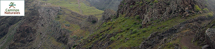
A unique and imposing landscape
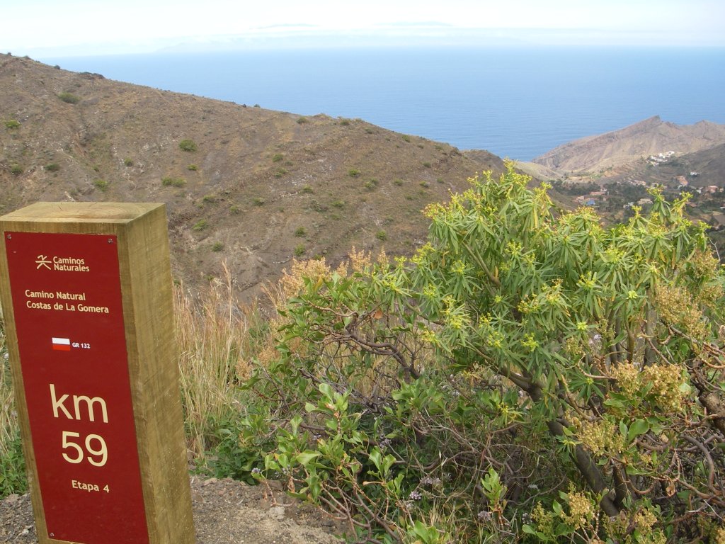
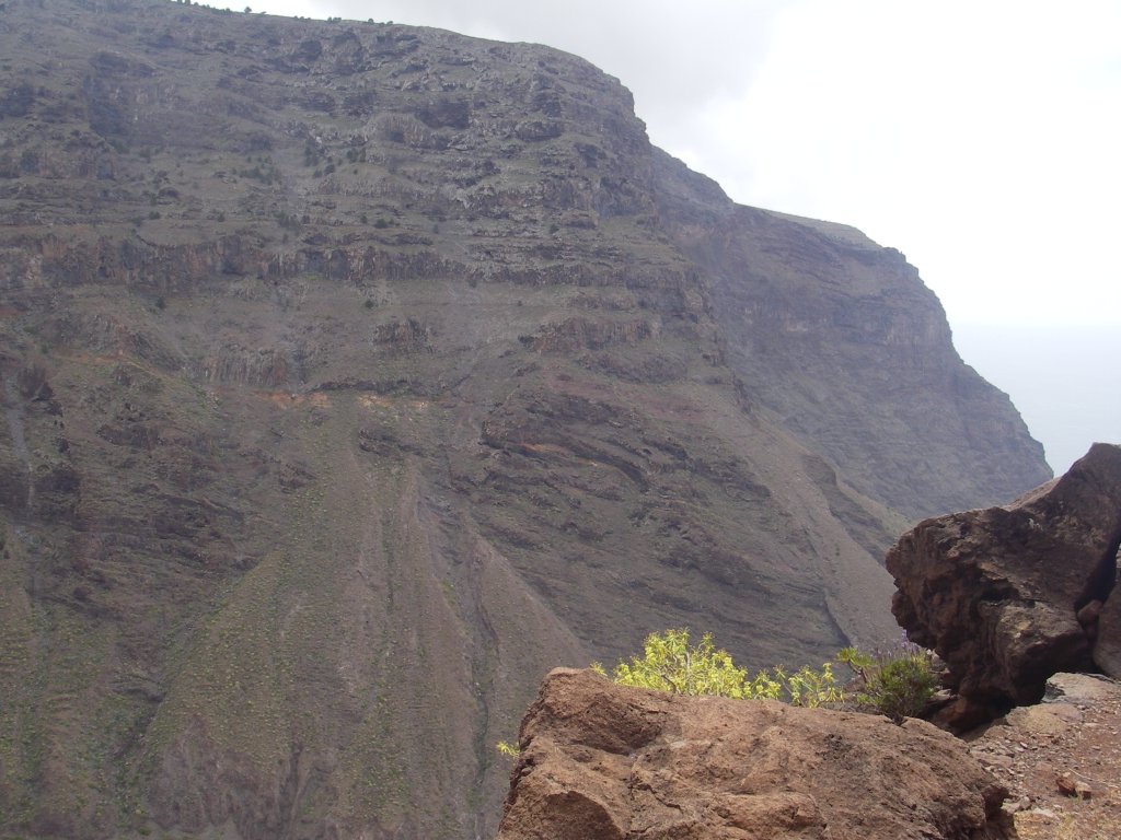
Along the 11.1 km of this Stage of the trail, the traveler goes through two important natural areas, Monumento Natural del Lomo del Carretón (Natural Monument Lomo del Carretón), an impressive basaltic cliff that separates the highlands of the central plateau from the lower lands, and Parque Rural de Valle Gran Rey (Rural Park of Valle Gran Rey), the only natural area in the whole island that has been awarded this conservation status. Hikers can enjoy the majestic vision of these landscapes, formed by almost vertical cliffs and deep ravines shaped over millions of years.

This Stage of the trail begins in the village of Alojera, municipality of Vallehermoso, along the street that goes from the CV-16 motorway to the main square of the village, where we can see the shrine of Ntra. Sra. de la Concepción. Here we should turn left, as indicated by a directional post, and continue up one of the steep streets of the village until, after kilometer marker #58, we take a detour to the right, near a power transformer, where another directional post shows us the distance to the village of Arure, 3.9 km away.
This urban Stage of the trail allows us to contemplate examples of the most traditional architecture of Gomera, represented by numerous stone-built houses with gable roofs covered with Arabic tiles “cooked” in the so called “tejeras” or community kilns.

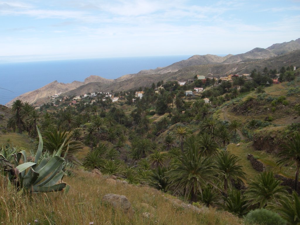
The small rural town of Alojera was one of the main exporters of tomatoes, a crop that was later replaced by potatoes, the presence of potato crops being quite noticeable today in the different agricultural terraces surrounding the village. However, one of the main pillars of the local economy has always been and still is the extraction of palm honey or guarapo; along the trail we will see several specimens of palm trees showing unmistakable signs that honey is being extracted from them, such as the fact that the crown of young leaves has been removed and a metal ring has been fixed around the trunk in order to prevent rodents from ascending the tree.
After the last houses of the village, the trail crosses Barranco del Mono (ravine of Mono, or ravine of the monkey), covered with a lush palm grove.

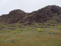
From this point, we begin a stretch of continuous ascent along Lomo del Cabezo (Cabezo Hill), while Lomo del Carretón (Carretón Hill) provides an incomparable backdrop.
As the trail ascends the hill, palms become increasingly scarce and are replaced by spurge (Euphorbia sp.), vinagreras or vinegar trees (Rumex lunaria) and pitas or century plants (Agave americana), which cover the barren terraced hillside. On the right side of the path, there are several scattered specimens of junipers (Juniperus phoenicea) dotting the hillside of Punta de Tejeleche (Tejeleche Ridge), which marks the dividing line with the municipality of Valle Gran Rey and the valley of Taguluche.
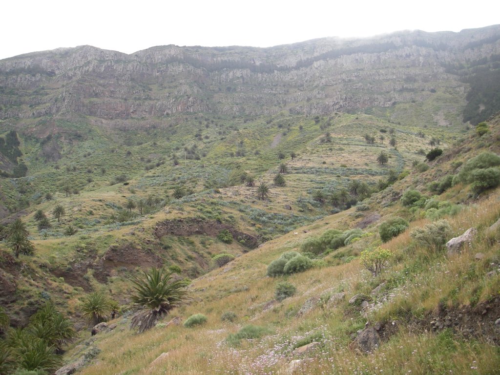
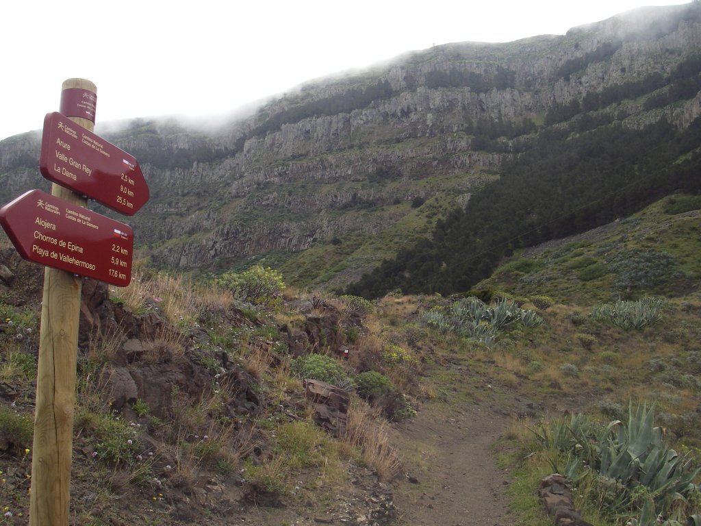
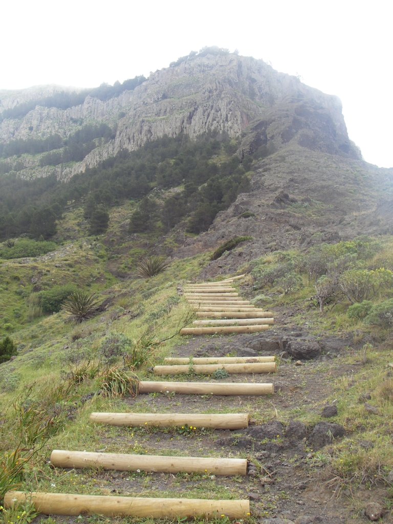
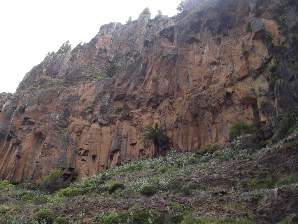
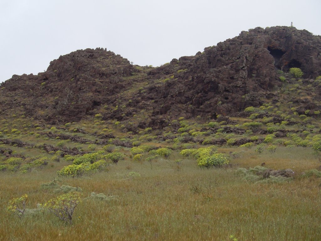
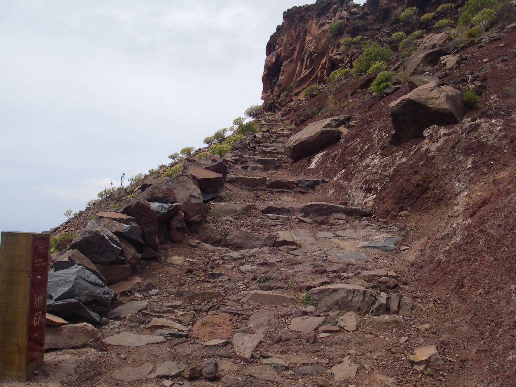
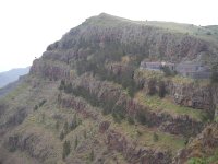
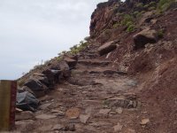
After a little more than a kilometer of ascent up the hill, we reach the Taguluche motorway near Cabezo de Bustillo. After crossing this road, the trail continues its ascent toward Arure along a set of steps, against the backdrop of the impressive vertical walls of Monumento Natural del Lomo del Carretón (Natural Monument Lomo del Carretón), a large, rugged ridge formed by strips of horizontal basalt with altitudes ranging from 450 to 850 m. After reaching a sign showing that the distance to Arure is 2.5 km, the trail enters an area known as Lomo de Tellerenche (Telerenche Ridge) and the climb becomes more challenging, with wooden steps in some sections of the path to make the ascent easier.
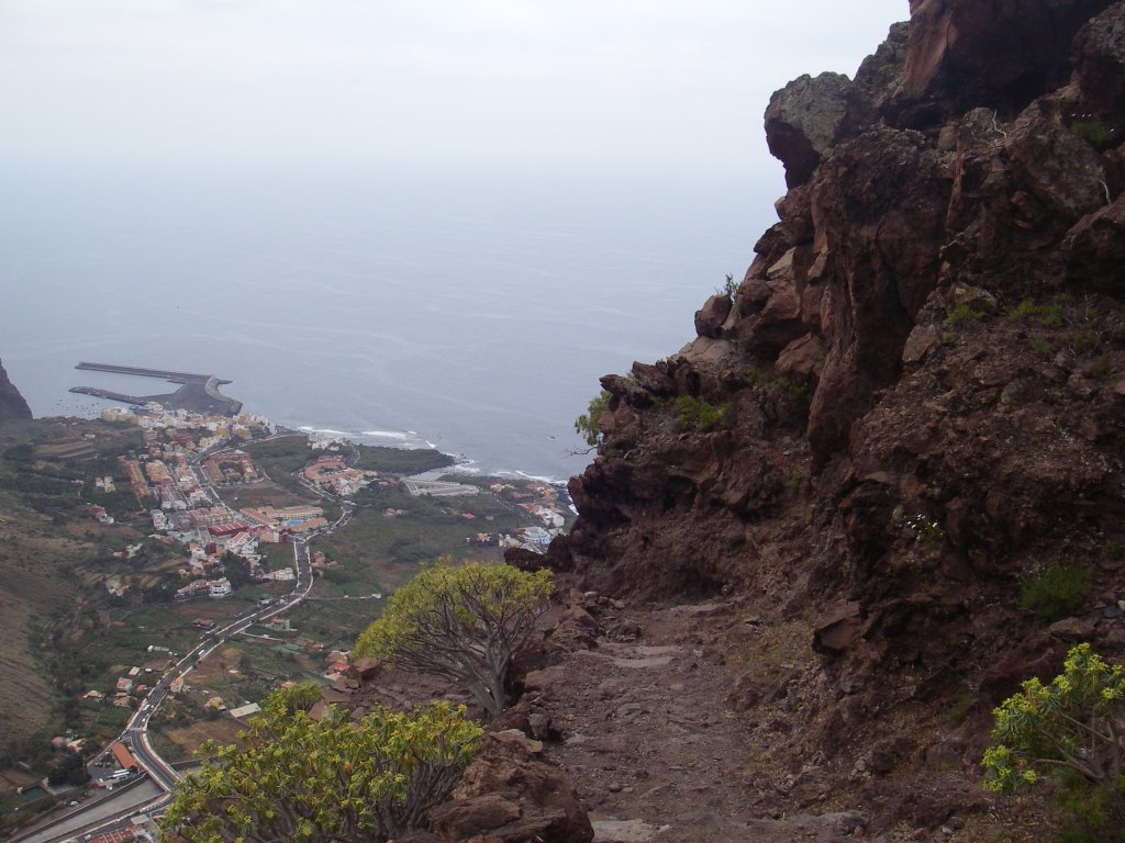
Some 500 m after kilometer marker #60, there begins a twisty ascent between rows of Canary Islands pines (Pinus canariensis), that will take us to the top of the small ridge of Teclarenche, which serves as a lookout from which we can enjoy beautiful views of Barranco del Mono and Alojera, with the island of La Palma always visible on the horizon. From this vantage point, we can see on the left the heights of Tejeleche, the ravine of Taguluche and the rural town of the same name.
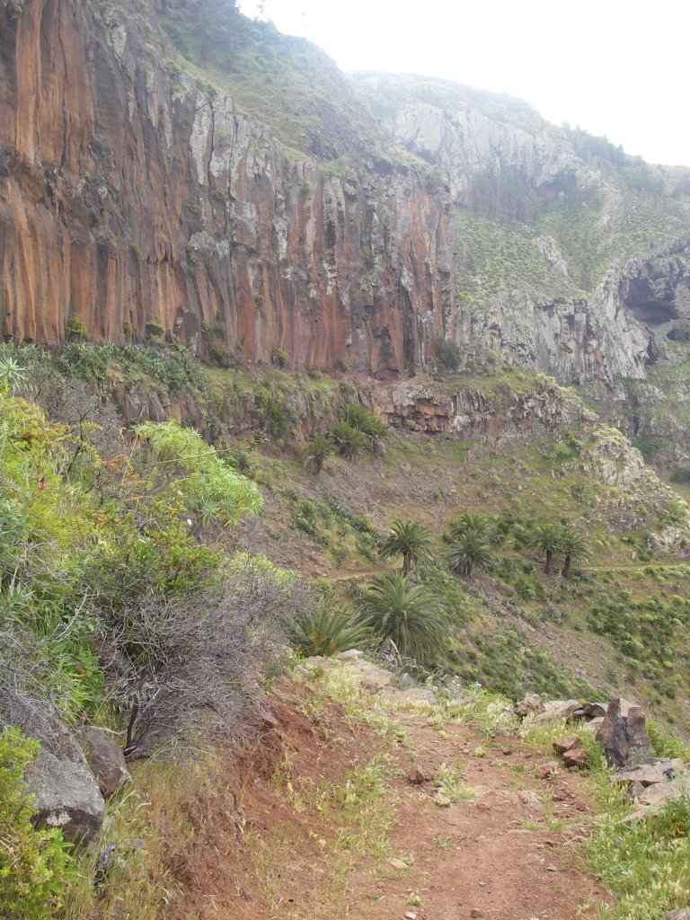
The route continues towards Arure by the so called Camino de las Correderas (Correderas Road), which is literally hanging from the enormous basalt cliffs of Lomo de Carretón.
While enjoying the superb landscape, we can find along the way some of the rare botanical treasures hidden between cliffs and slopes, such as Sideritis nutans, Pimpinella junoniae, ecardoncillo or lantern flowers (Ceropegia ceratophora), Crambe wildpretii, Sonchus gonzalez-padronii, balillo (Sonchus filifolius), Aeonium rubrolineatum and tree Euphorbias (Euphorbia lambii).
It is much easier to find species of succulents such as the bea (Aeonium subplanum), the Greenovia diplocyla or the Monanthes laxiflora, growing on bare rock. Easily recognizable are also Monterey pines (Pinus radiata) and Aleppo pines (Pinus halepensis), whose origin is in reforestation works, along with rock roses, spineless cacti and prickly pears, balsamiferous spurge (Euphorbia balsamifera), senecios or ragworts, incense plants or Swedish ivy and a few isolated palm trees.
The trail now continues along an almost flat stretch, always at the edge of the ridge and at the foot of spectacular rocky walls, in the middle of a unique natural environment that will certainly remain etched in the memory of travelers. After some 400 m, the trail continues along an approximately 200 meter-long Stage of ascent that is a little more challenging, at the end of which we will see again numerous pines flanking the path until we reach the overlook of Arure or del Santo.
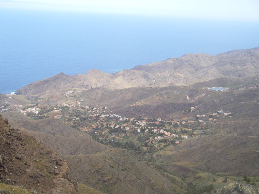
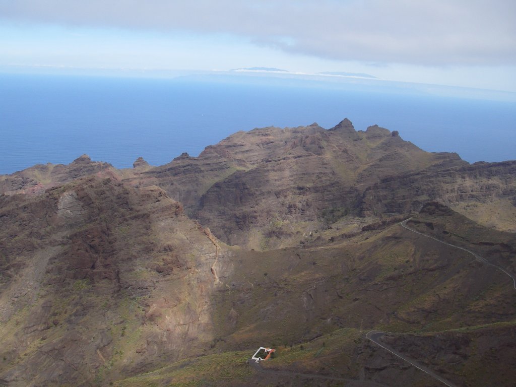
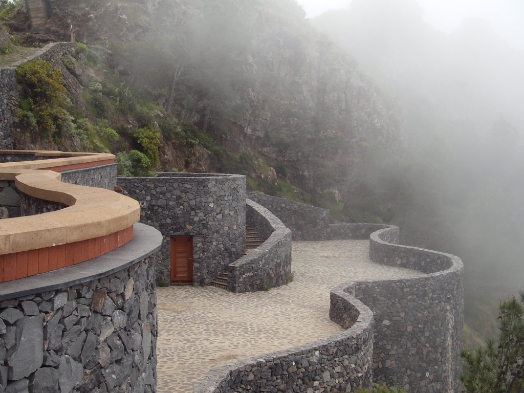
We arrive at the overlook near kilometer marker #62, passing by the small shrine of San Salvador. Mirador del Santo (Lookout of the Saint), an unfinished work by César Manrique, overlooks the valley of Taguluche, providing an aerial panoramic view of the village and the ravine, carpeted with palms and flanked on one side by the cliffs of Heredia, and the roques of Medio and of Marroyos and, on the other side, by the roque of Mona and the cliff of Tejeleches.
Once the traveler has enjoyed the splendid views from this point, and in order to continue the trail, he shall leave the viewpoint and turn right along an asphalted road, until reaching some private homes; then the road turns right and becomes a dirt track that leads to Llanos de la Mérica (Mérica Plains).
The first part of the track offer good panoramic views of the ravine of Arure, on one side, and, on the other side, of the ravine of Taguluche, a small village that, until relatively recently, was not connected by any road.
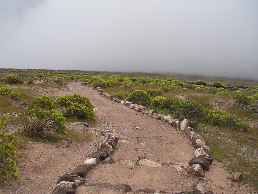
After skirting peak Picorosa, the road veers left along the hill, where it is easy to see many goats grazing freely. After about 1 kilometer, and having already entered the boundaries of Parque Rural de Valle Gran Rey (Rural Park Valle Gran Rey), we must take a fork in the trail to left in order to continue a gentle ascent along the hill, surrounded by spurge, century plants (Agave americana) and gorse. Later, the trail veers right along a properly marked stretch of steps where we soon see the 64-kilometer marker of the route.
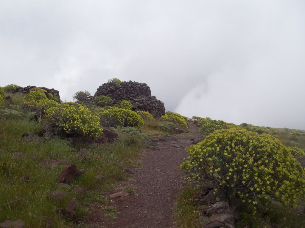
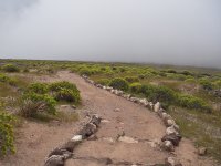
The gentle and smooth progress in this part of the route makes it easier to enjoy the trail, since - the frequent presence of fog permitting - we can see along the road a majestic scenery, enjoy the view of immense ravines whose eroded slopes show several layers of materials created as a result of different eruptive events, and admire the precipitously vertical cliff faces, as well as the amazing fractured columnar joints created by basalt flows. Walking through these lands, it is not difficult to appreciate why this is one of the most frequented routes of the island.
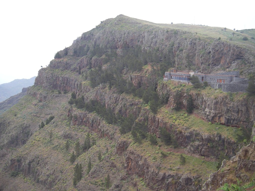
The trail now runs next to a rocky wall where there is a large hollow space; it is the cave of Terejiguete, used as shelter by a great number of goats that we will surely see along the way, since they seem to have the run of the place in this area. The gentle ascent ends when we reach Llanos de la Mérida, a plateau that used to be covered by grain croplands, and we move away from the highest point of the hill, La Mérica, 834 m.
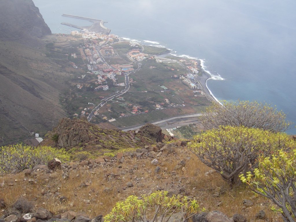
The trail continues in a gentle descent along the plains of La Merica, passes by an old lime kiln in ruins, and leaves the cliffs of the same name, home to a flora of high botanical significance and to the single surviving community of the giant lizard of La Gomera (Gallotia bravoana). Just 10 min away from the trail you can enjoy stunning views of the beach of Playa del Inglés.
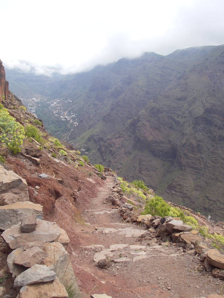
We must now continue our route though the nature trail; first, along a steep and winding descent down the area known as Quiebra Canillas (gorges of Canillas), whose name sums up quite clearly the nature of the twisty decent along this tough Stage of the trail, which is well marked and demands, once again, a minimum level of caution and physical fitness.
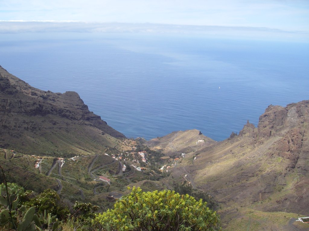
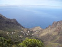
In the course of almost 3 km of tough descent, we will be able to enjoy the beautiful scenery of Valle Gran Rey (Valley of the Great King), one of the most impressive ravines in La Gomera.
Once we reach La Calera, capital of the municipality, we must turn right along an asphalt street and go down a set of steps to a parking located next to the main road CV-7, where a trail information board marks the end of this challenging but spectacular Stage of nature trail Costas de La Gomera.
Profile
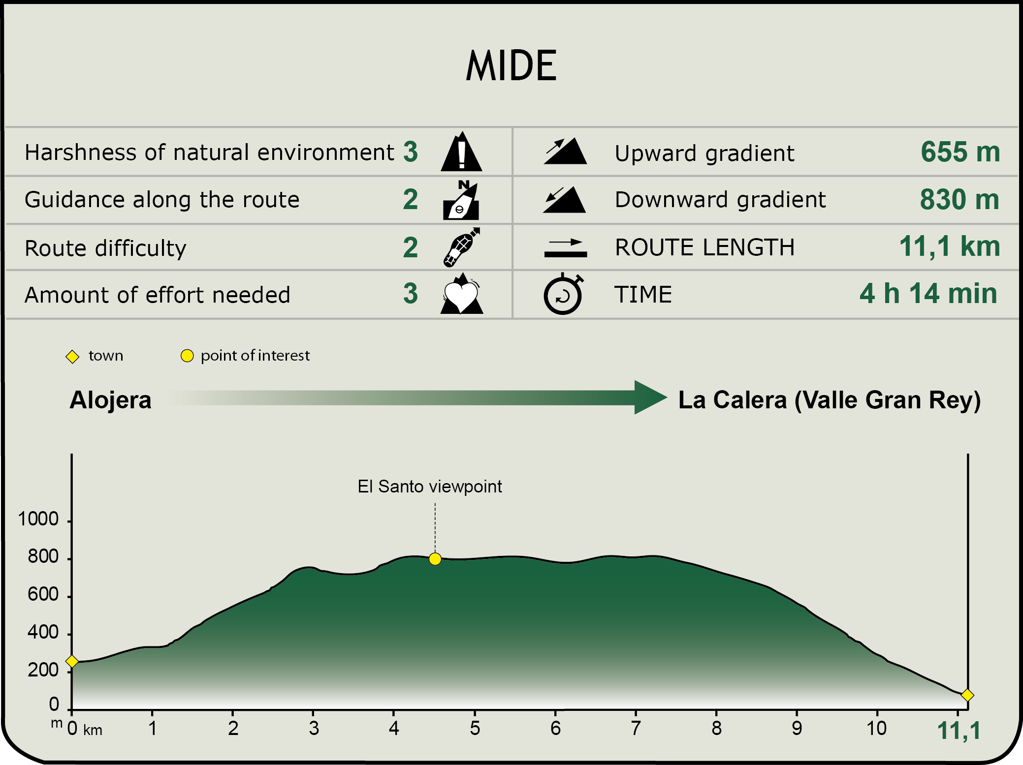
MIDE (Method for the Information of Excursions)
 Harshness of natural environment
- 1. The environment is not risk-free
- 2. There are more than one risk factors
- 3. There are various risk factors
- 4. There are quite a lot of risk factors
- 5. There are many risk factors
 Guidance along the route
- 1. Well defined trails and crossings
- 2. There is a clearly marked trail and signage
- 3. Requires the identification of geographic features and cardinal points
- 4. Requires off-path navigation
- 5. The trail is interrupted by obstacles that have to be gone around
 Route difficulty
- 1. Walking on a flat surface
- 2. Trails with different types of path
- 3. Walking on stepped paths or irregular terrain
- 4. The use of hands or jumping over the terrain is necessary
- 5. The use of hands is required to progress
 Amount of effort needed
- 1. Up to 1 hour of continuous walking
- 2. Between 1 and 3 hours of continuous walking
- 3. Between 3 and 6 hours of continuous walking
- 4. Between 6 and 10 hours of actual walking
- 5. More than 10 hours of continuous walking
Featured
Further information
Parque Rural de Valle Gran Rey
Parque Rural de Valle Gran Rey (Rural Park Valle Gran Rey) is located south of the island, in the municipality of Valle Gran Rey. It has an area of 1,993 ha, with elevations ranging from sea level to 1,020 m. Within its boundaries, we find the two highest points bordering the valley: la Mérica (834 m) and Teguerguenche (662 m), as well as part of the ravine that is located beyond La Casa de la Seda, toward the cliff of Guadá.
In accordance with its conservation status, in Parque Rural de Valle Gran Rey agricultural and livestock activities coexist with environmental and forestry activities, thus forming a landscape of great ecological and cultural significance, well deserving of the high conservational status it has been awarded.
The wildlife in the park is also of great significance, since this area is the last refuge of the giant lizard of La Gomera (Gallotia bravoana), a species endemic to the Canary Islands and one of the most endangered vertebrates on the planet, its single and last population group living in the base of La Mérica cliff, in a range state of just about 1 km2.
Multimedia