- Home
- Rural Development
- Nature Trails
- Nature Trails
- Central Sector
- Sierra de Alcaraz
Sierra de Alcaraz Greenway Nature Trail. Albacete-Balazote Section
Description
Through the Albacete plain
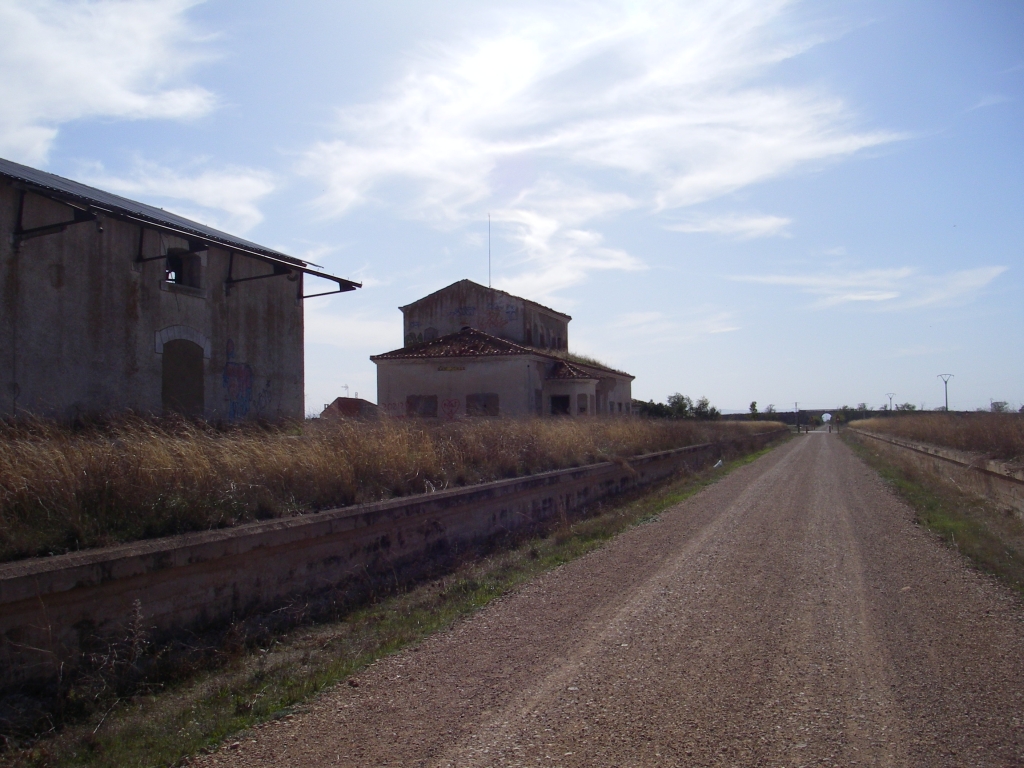
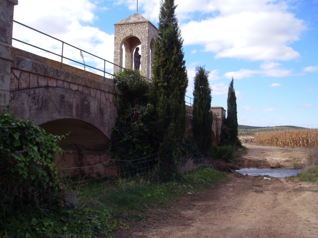
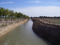
Leaving from the capital city of Albacete and taking advantage for most of its route of the unfinished Baeza-Utiel railway platform, the trail crosses La Mancha plain among bare areas, dry lands sown with cereals, irrigation crops and scrubland areas, until it reaches the bridge over the River Mirón, close to Balazote. During your trek, you can see the still well-preserved brick works built for the railway, as well as the buildings for the planned stations of San Jorge and Las Santanas, which never provided a service as the works were halted in 1963.
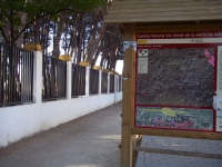
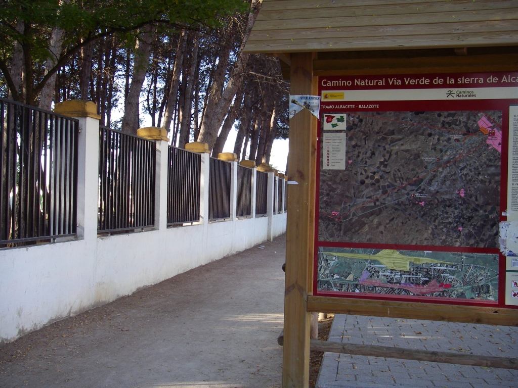
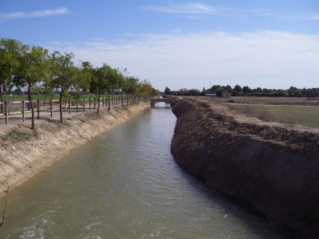
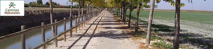
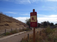
This section of the Sierra de Alcaraz Nature Trail begins in the city centre of Albacete, next to the Fiesta del Árbol park, where an informative panel, surrounded by a wooden railing, marks the beginning of the route. This Nature Trail shares its first 5.9 km, in the city’s peri-urban area, with different sections of the María Cristina Canal Nature Trail and its branches, given the fact that, in these initial kilometres, recovery of the railway platform was impossible.
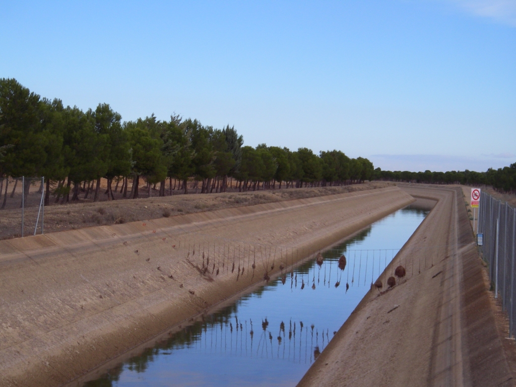
After walking some 2 km, you reach a spot known as "El Palo", where you can rest and freshen up, as it has a drinking water fountain. You then cross the bridge again, to continue along the right-hand-side bank of the canal until you reach its first fork (KP 3.7 of the route). At this point, and following the instructions on the signs, the trail continues along El Acequión canal branch, leaving on the left that of La Estacadilla canal.
Continue along the right-hand-side bank of the canal, until you reach a floodable underpass (at approximately KP 4), which you use to cross the A-32 highway.
You should take into account that the María Cristina canals were built to drain the wetlands surrounding Albacete and may be carrying water depending on the groundwater level. If this occurs, this underpass is closed. As an alternative route, you can use the aforementioned branch of La Estacadilla canal, which you can take by returning to the fork at KP 3.7. After walking some 7.5 km, this branch joins up at KP 11.5 with the Sierra de Alcaraz Nature Trail.
If the pass under the A-32 is water free, after crossing it, you can continue along the branch of the Acequión canal. On reaching the next fork (KP 4.5), you should not leave it but turn rightwards, passing on your left Los Ojos de San Jorge canal branch.

A little further on, you come to the spot known as the "Huerta del Rey", or the King’s Kitchen Garden, where you will find a recreational area containing drinking water. Continue along the left-hand-side bank of the canal until you arrive at El Acequión rest area (KP 5.9). Here, after turning to the left and crossing the bridge, the trail finally leaves the branches of the María Cristina canal to rest almost in its entirety, for the next 24.8 km, on the old Baeza-Utiel railway platform.
At KP 6.6, you will find your first railway relic, a walkway built over the railway platform to avoid the level crossing. This point marks the beginning of a long straight stretch (4.9 km). Some metres before KP 9, the trail is no longer asphalted and is made of compact artificial gravel, which is perfectly fitted out for practising cyclo-tourism or trekking. In this first section, the trail once again intersects the branch of Los Ojos de San Jorge canal (KP 7.9), until it reaches the old station of San Jorge and the eponymous rest area (KP 9). After leaving behind a second deserted railway crossing, you reach, at the end of a slight bend to the left, the intersection with the end of the Estacadilla canal branch (KP 11.5).
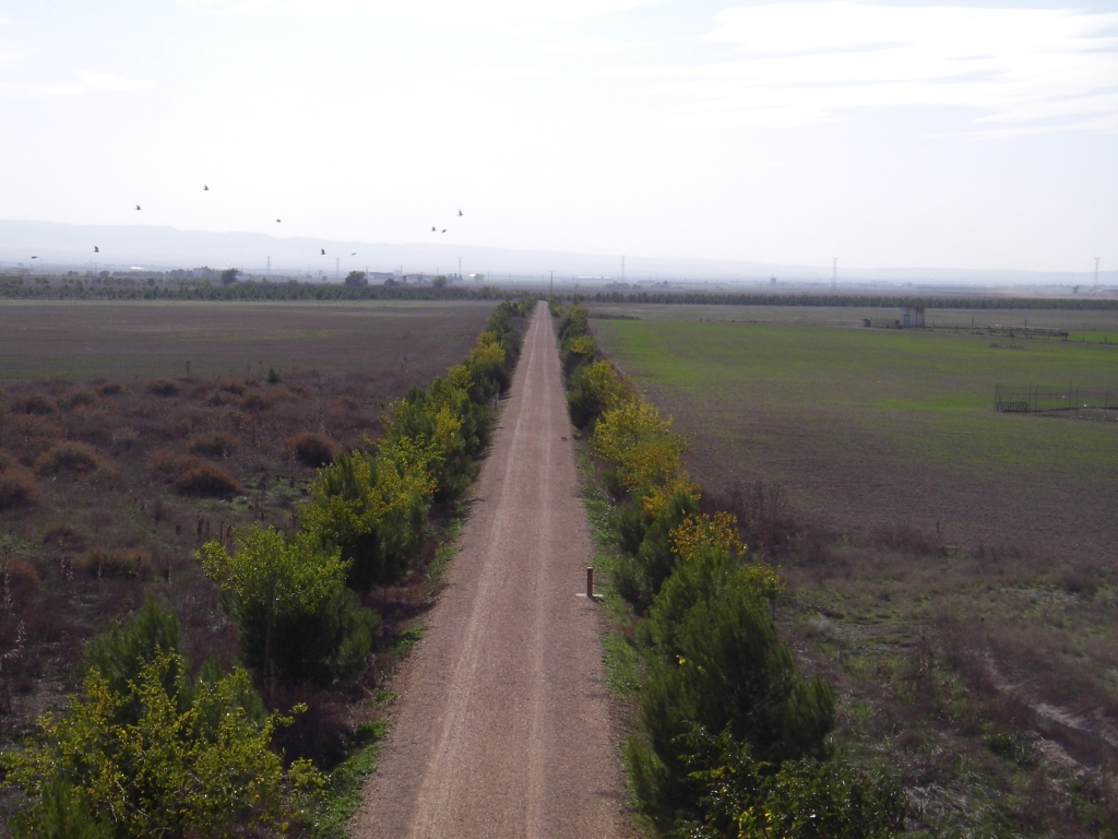
After a short straight section, the trail then crosses the N-322 highway and turns rightwards. It then continues in a straight line for another 4 km as far as “Las Santanas” rest area (KP 17). The landscape you can see on both sides of the trail for these first kilometres of the route is that typical of the plain of La Mancha, characterised by extensive, bare agricultural fields, which are fallow or mainly sown with cereals and irrigation crops (corn and alfalfa).
After turning to the right once again, you continue along another straight section for 9.3 km as far as the outskirts of Balazote. In this final part of the trail, and once you have passed the Tajo-Segura aqueduct (approximately KP 20), the landscape changes and the trail enters areas where there is a predominance of Mediterranean scrubland, strewn with Holm-oaks (Quercus ilex) and Aleppo pine (Pinus halepensis) stands.At this point of the route, if you pay attention to your environment and you are lucky, you might be able to see the characteristic fauna of the area represented by the common rabbit (Oryctolagus cuniculus), the hare (Lepus granatensis), the fox (Vulpes vulpes) and birds, such as the European snake eagle (Circaetus gallicus), the common buzzard (Buteo buteo) and the wood pigeon (Columba palumbus).
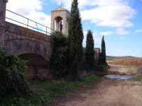
At approximately KP 26.3, the trail turns sharply to the right. This occurs because, from this point as far as KP 28.9, the old railway platform, after the works were abandoned, was reversed and is closed. After covering 2.6 km of paths that are open to motorised traffic, the route returns to the original railway line until it reaches the bridge over the River Mirón, 1.6 km from Balazote. This is the last of the remains of the railway you can see, as it was built to withstand the passing of the trains, although once the railway works were abandoned, its access embankments were dismantled. The Sierra de Alcaraz Nature Trail ends at this point.
Sites of interest
Map
Puntos de Interés
Profile
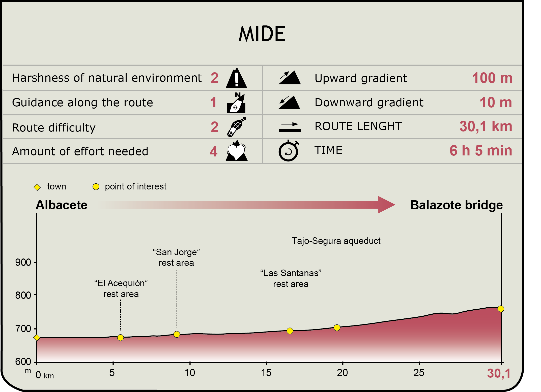
MIDE (Method for the Information of Excursions)
 Harshness of natural environment
- 1. The environment is not risk-free
- 2. There are more than one risk factors
- 3. There are various risk factors
- 4. There are quite a lot of risk factors
- 5. There are many risk factors
 Guidance along the route
- 1. Well defined trails and crossings
- 2. There is a clearly marked trail and signage
- 3. Requires the identification of geographic features and cardinal points
- 4. Requires off-path navigation
- 5. The trail is interrupted by obstacles that have to be gone around
 Route difficulty
- 1. Walking on a flat surface
- 2. Trails with different types of path
- 3. Walking on stepped paths or irregular terrain
- 4. The use of hands or jumping over the terrain is necessary
- 5. The use of hands is required to progress
 Amount of effort needed
- 1. Up to 1 hour of continuous walking
- 2. Between 1 and 3 hours of continuous walking
- 3. Between 3 and 6 hours of continuous walking
- 4. Between 6 and 10 hours of actual walking
- 5. More than 10 hours of continuous walking
Featured
Further information
The Baeza-Utiel railway
This railway track’s project was included in the Urgent Railway Construction Preferential Plan (Guadalhorce Plan) of 1926, which, among others, foresaw the construction of a strategic line whose aim was to link Algeciras to the French border.
To this end, a railway was projected from Baeza station (currently called Linares-Baeza) to Saint-Girons (the Algeciras to Baeza route used lines that already existed) passing through Albacete, Utiel, Teruel, Alcañiz and Lérida. This line was divided into several sections: Lérida - Saint-Girons (175 km), Baeza - Utiel (366 km), Utiel - Teruel (100 km) and Teruel - Lérida (273 km). Whereas in some sections (Utiel-Teruel) the works were never begun, in others, they were even inaugurated (Lérida-La Pobla, which is still in operation).
The Baeza to Utiel section totalled 366 km, which was divided into four sections. In January 1932, the time when the "Guadalhorce Plan" was repealed, 60% of the first three sections, which totalled 246 km and joined Baeza to Albacete, had been executed, whereas the section between Albacete and Utiel (30%) was delayed.
After the Civil War, the works were only resumed in the first three sections. Nevertheless, when the track (including ballast, sleepers and rails) had already been laid in the 116 km of the third section (province of Albacete) and the bid for the assembly of the track in the first two sections was about to be announced (province of Jaén), a report by the International Reconstruction and Development Bank(belonging to the World Bank) in 1962 made the Ministry of Public Works provisionally stop the construction of this line in January 1963. The only part of this line that was brought into service was the new station in Albacete, which was replaced in 2010 by the current Albacete-Los Llanos line.
The works were finally abandoned in 1985 and the track assembled in the section in the province of Albacete was dismantled in 1991.
La Bicha de Balazote
Together with La Dama de Elche and La Dama de Baza, La Bicha de Balazote is one of the most emblematic examples of Iberian sculpture. It is thought to have been sculpted in the late 6th century BC, using two limestone blocks. It represents an androcephalous bull and was probably adjoined to the corner ashlar of a burial monument similar to that of El Pozo Moro (Chinchilla, Albacete). Although the original sculpture, found at the foot of the hill where Balazote stands, has been stored in the National Archaeological Museum (Madrid) since 1910, you can see a reproduction at the entrance to Balazote town hall.
Multimedia